

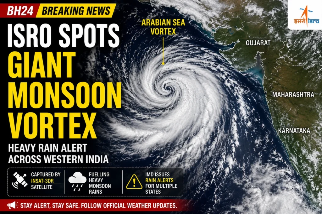

Fresh satellite images released by the Indian Space Research Organisation (ISRO) have revealed a massive Arabian Sea Vortex powering intense monsoon activity over western India. Captured by the INSAT-3DR weather satellite, the striking images show a huge spiral of dense clouds over the Arabian Sea, feeding moisture into Gujarat and nearby regions.
The visuals have quickly gone viral on social media, with many calling them one of the clearest space views of this year’s active monsoon. Meteorologists say the vortex is helping strengthen rainfall across several states, increasing the risk of flooding and travel disruption.
Arabian Sea Vortex Powers Relentless Rainfall
The Arabian Sea Vortex is a large cyclonic circulation that pulls warm, moisture-rich air from the sea towards land. As this moisture collides with monsoon winds, it produces widespread heavy rainfall.
According to the India Meteorological Department (IMD), Gujarat remains the worst-affected state, with heavy to very heavy rain expected in several districts. Parts of Rajasthan, Madhya Pradesh, Maharashtra and nearby regions may also receive intense showers over the next couple of days.
Authorities have advised people living in low-lying areas to remain alert as rivers continue to swell. Local administrations are monitoring flood-prone regions and have asked residents to avoid unnecessary travel during periods of intense rainfall.
ISRO’s Satellite Images Reveal Nature’s Power
The INSAT-3DR weather satellite captured an extraordinary view of the vortex from space. The satellite imagery shows tightly packed cloud bands rotating over the northeastern Arabian Sea before moving inland.
Weather experts say such images help scientists track the movement of monsoon systems with greater accuracy. They also improve rainfall forecasting, allowing authorities to issue timely warnings and prepare emergency response teams before weather conditions worsen.
The dramatic images have attracted widespread attention online, with thousands of users sharing the photographs and praising ISRO’s advanced weather-monitoring capabilities.
Why Scientists Are Watching This Weather System Closely
Although the active monsoon is beneficial for agriculture and water reservoirs, persistent heavy rainfall also increases the risk of flash floods, landslides and urban waterlogging.
Experts believe the Arabian Sea Vortex will continue influencing weather patterns across western and central India until the circulation gradually weakens. Forecasts suggest intermittent heavy rainfall may continue in several states over the coming days.
Meteorologists are closely monitoring the system for any changes in intensity or movement that could affect additional regions.
IMD Urges Residents to Stay Alert
The IMD has urged people in affected areas to keep track of official weather updates and follow local administration advisories. Travellers have been advised to check road and rail conditions before beginning their journey, while fishermen have been warned against venturing into rough sea conditions.
With the monsoon remaining highly active, authorities are expected to continue monitoring the Arabian Sea Vortex around the clock. As fresh satellite data becomes available, weather agencies will provide updated forecasts to help people stay safe during this period of intense rainfall.
Also Read: MV Golden Leo Attack: Four Indians Killed Near Ukraine